Search Results
Found 523 records
| No | Image | Details | Add to Album |
|---|---|---|---|
| 1 |  | v00021 Aerial view of Broomhill and Broomhall area from a hot air balloon. Hallamshire Hospital in the distance | |
| 2 |  | v00022 Aerial view of Abbeydale and Beauchief area from a hot air balloon. Abbey Lane and Abbeydale Road South junction in foreground | |
| 3 |  | v00024 Aerial view of the 1st, 2nd and 4th Greens, Abbeydale Golf Club, from a hot air balloon | |
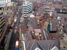
| 4 |  | a01242 Aerial view of Orchard Square looking along Leopold Street | |
| 5 |  | a01243 Aerial view of Town Hall clock tower | |
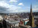
| 6 |  | a01244 Aerial view looking at the spire of St Marie's Roman Catholic church on the right and on the far left the white building of Kemsley House, High Street | |
| 7 |  | a01247 Aerial view across the city centre towards Sheffield Cathedral and Parkwood Springs Ski Village, which was subsequently destroyed by fire in 2013. | |
| 8 |  | a01260 Aerial view looking down Fargate and beyond towards Kemsley House (the white building) on High Street | |
| 9 |  | s22644 Aerial view of the Northern General Hospital, with the new Spinal Injuries Unit (top centre) and Brearley Wing (top right hand corner) Herries Road in foreground | |
| 10 |  | s22716 Aerial view of Rother Valley Country Park |
Found 523 records.