Record Detail
Large format version available - click on Zoom button to browse this image in a zoomable viewer
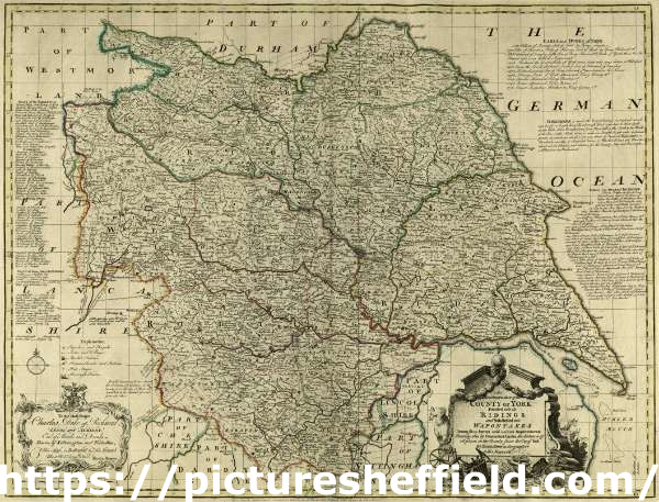
| y14989 | |
| County Map of Yorkshire, by Emanuel Bowen, Thomas Kitchin and others, c. 1777 | |
| Sheffield | |
| 1500-1799 | |
Marked (amongst other places): Sheffield, Broom Hall [Broomhall], High House, Stannington, Lockesleys Chase [Loxley Chase], Bradfield, Worrall, River Dun [River Don], Wancliffe Park [Wharncliffe Park], Bowsterston [Boslsterstone], Midhope, Underbank, Heley [Heeley], Gledles [Gleadless], Sheffield Mannor [Sheffield Manor], Shirtcliffe [Shirecliffe], Brighouses, Grimsthorp [Grimesthorpe], Temple Brough [Templeborough], Hansworth [Handsworth], Attercliff [Attercliffe], Woodhouse, River Rother, Treton [Treeton], Wales, Norton [Derbyshire], Barnsley, Rotherham, Doncaster, etc. From The Large English Atlas: or, a new set of map of all the counties of England and Wales drawn from the several surveys which have been hitherto been published. With three general maps of England, Scotland and Ireland, from the latest and best authorities, by Emanuel Bowen, Thomas Kitchin and others. London, printed and sold by T. Bowles, [c.1777]. Original at Sheffield Reference Library: 912 STF. |
Copying and access
This digital image, and all images on Picture Sheffield, are protected by copyright. You may use it for private study or non-commercial research, with due acknowledgement.
You may share it on social media via a linked post or by citing www.picturesheffield.com together with the Image Reference, unless its copyright is noted as belonging to another organisation. You must not reproduce it by any other means without permission.