Record Detail
Move cursor over image to magnify
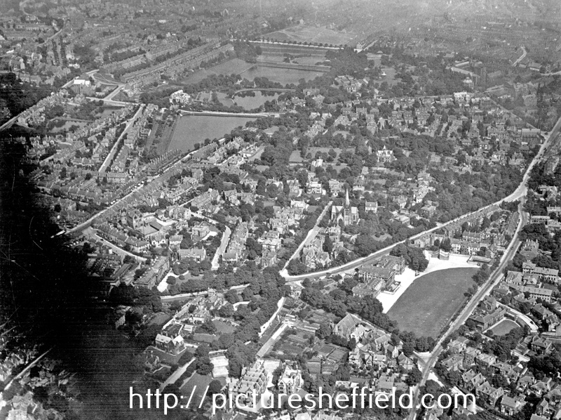
| s12389 | |
| Aerial view - Broomhill | |
| Sheffield_Broomhill | |
| 1920-1939 | |
Including (left-right) Glossop Road, Rutland Park (note High School), King Edward VII School and Clarkehouse Road, foreground, St. Mark's Church, Broomfield Road, centre, Whitham Road and Godfrey, New and Old Great Dams, background. Misfortune Dam and Ralph's Dam can be seen in background, extreme left. |
Copying and access
This digital image, and all images on Picture Sheffield, are protected by copyright. You may use it for private study or non-commercial research, with due acknowledgement.
You may share it on social media via a linked post or by citing www.picturesheffield.com together with the Image Reference, unless its copyright is noted as belonging to another organisation. You must not reproduce it by any other means without permission.