Record Detail
Large format version available - click on Zoom button to browse this image in a zoomable viewer
| q00027 | |
| Ordnance Survey Map, sheet no. Yorkshire 294.3.18 (south east) | |
| Sheffield_Walkley | |
| 1890 | |
| 1851-1899 | |
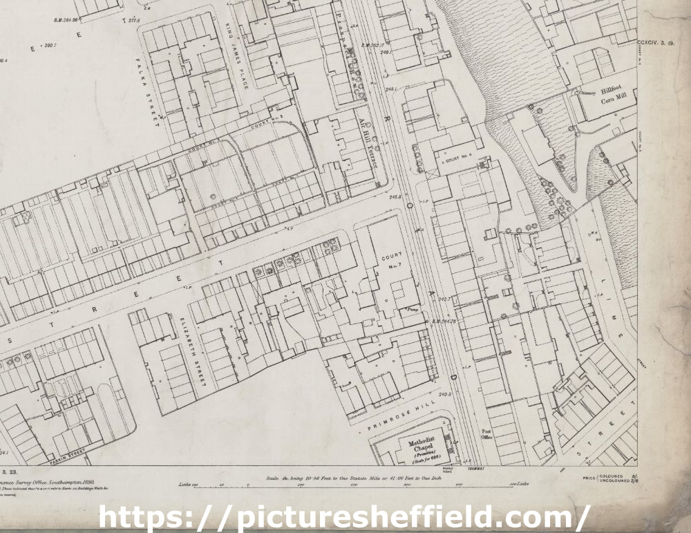
This map features: King James Street, Creswick Street, Langsett Road, Tramway, King James Place, Prospect Row, Falka Street, Air Hill Terrace, Hillfoot, Corn Mill, Lime Street, Elizabeth Street, Primrose Hill, Ash Street, Methodist Chapel, Parkin Street. Scale 10.56 feet : 1 mile [1:500]. Original at Sheffield City Archives. |
Copying and access
This digital image, and all images on Picture Sheffield, are protected by copyright. You may use it for private study or non-commercial research, with due acknowledgement.
You may share it on social media via a linked post or by citing www.picturesheffield.com together with the Image Reference, unless its copyright is noted as belonging to another organisation. You must not reproduce it by any other means without permission.