Record Detail
Large format version available - click on Zoom button to browse this image in a zoomable viewer
| arc03415 | |
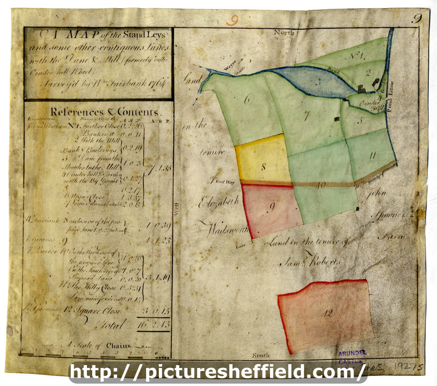
| A map of the Stand Leys and some other contiguous Lands with the Dam and Mill (formerly called Cinder Hill Wheel) | |
| Sheffield_Bradfield | |
| 1764 | |
| 1500-1799 | |
Scale 3 chains : 1 inch [26.6 inches : 1 mile]. Surveyor: William Fairbank II. The wheel and dam clearly shown; shuttle marked; colours distinguish tenancies; numerical list with tenants, field names and descriptions and acreages; on parchment. Pond Corn Mill (on the Porter) and some of the Stand Ley Closes (also known as the Cinder Hill Wheel, this mill was west of modern Leadmill Road near Shoreham Street; the Stand Ley Closes lay to the south and west of the mill and dam). Clough House Lane, with the site of Clough House shown. Lenton Street, Duchess Road, Pond Corn Mill, Mary Street, Margaret Street, Matilda Street, Pond Street (south end), St. Mary's Road. Dimensions: 26 x 23 cm. Original at Sheffield City Archives: ACM/MAPS/SheS/1927s. Digitised with financial support from Sheffield and District Family History Society in memory of Professor David Hey (1938-2016) founder and life president of the Society.
|
Copying and access
This digital image, and all images on Picture Sheffield, are protected by copyright. You may use it for private study or non-commercial research, with due acknowledgement.
You may share it on social media via a linked post or by citing www.picturesheffield.com together with the Image Reference, unless its copyright is noted as belonging to another organisation. You must not reproduce it by any other means without permission.