Record Detail
Large format version available - click on Zoom button to browse this image in a zoomable viewer
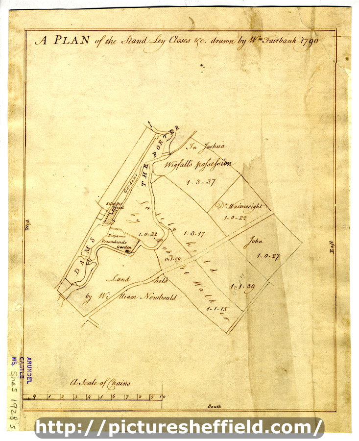
| arc03414 | |
| A plan of the Stand Ley Closes, etc | |
| Sheffield_Bradfield | |
| 1790 | |
| 1500-1799 | |
Scale 3 chains : 1 inch [26.6 inches : 1mile]. Surveyor: William Fairbank II. The closes adjoining those shown in arc03415 with an outline of the Sylvester wheel and dams; Tenants and acreages given. (St. Mary's Road, Charlotte Road, Clough Road, Clough House Lane, Hereford Street, Sylvester Street, Mary Street, Midland Lane, Margaret Street, Shoreham Street) [Sylvester Wheel and the closes to the south (these closes adjoin those in the section above; the wheel was on the Porter Brook near modern Sylvester Street] B, p. 56. Dimensions: 23 x 28.5 cm. Original at Sheffield City Archives: ACM/MAPS/SheS/1928s. Digitised with financial support from Sheffield and District Family History Society in memory of Professor David Hey (1938-2016) founder and life president of the Society. |
Copying and access
This digital image, and all images on Picture Sheffield, are protected by copyright. You may use it for private study or non-commercial research, with due acknowledgement.
You may share it on social media via a linked post or by citing www.picturesheffield.com together with the Image Reference, unless its copyright is noted as belonging to another organisation. You must not reproduce it by any other means without permission.