Record Detail
Large format version available - click on Zoom button to browse this image in a zoomable viewer
| arc03406 | |
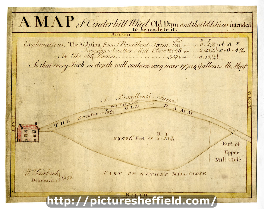
| A map of Cinderhill Wheel Old Dam and the additions intended to be made to it | |
| Sheffield_City_Centre | |
| 1752 | |
| 1500-1799 | |
Scale not stated. Surveyor: William Fairbank I. The old and new dams clearly shown, with a perspective drawing of the mill house. Measurements given on the map and there is an explanation of additions with acreages. Content of the new dam also given; house and border coloured. Pond Corn Mill (on the Porter) and some of the Stand Ley Closes (also known as the Cinder Hill Wheel, this mill was west of modern Leadmill Road near Shoreham Street; the Stand Ley Closes lay to the south and west of the mill and dam). Brittain Street, St Mary's Road, Shoreham Street, Pond Corn Mill, Mary Street, Pond Street (south end). B, p. 37. Dimensions: 26.5 x 21 cm. Original at Sheffield City Archives: ACM/MAPS/SheS/1926s. Digitised with financial support from Sheffield and District Family History Society in memory of Professor David Hey (1938-2016) founder and life president of the Society. |
Copying and access
This digital image, and all images on Picture Sheffield, are protected by copyright. You may use it for private study or non-commercial research, with due acknowledgement.
You may share it on social media via a linked post or by citing www.picturesheffield.com together with the Image Reference, unless its copyright is noted as belonging to another organisation. You must not reproduce it by any other means without permission.