Record Detail
Large format version available - click on Zoom button to browse this image in a zoomable viewer
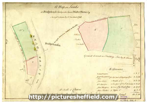
| arc03302 | |
| A map of the Lands at Bridgehouses lately under Lease to Walter Oborne, esquire | |
| Sheffield_Neepsend | |
| 1782 | |
| 1500-1799 | |
Scale 2 chains : 1 inch [40 inches : 1 mile]. Surveyor: William Fairbank II. Two of the Pye Bank Closes and two other closes by the Don; numerical list with tenants, field names and descriptions and acreages. (Alma Street, Corporation Street, Mowbray Street, Pitsmoor Road, Rock Street) [F.B. 56, supp, pp. 83-84] C, p. 17. Dimensions 37.5 x 26 cm. Original at Sheffield City Archives: ACM/MAPS/SheS/1801s. Digitised with financial support from Sheffield and District Family History Society in memory of Professor David Hey (1938-2016) founder and life president of the Society.
|
Copying and access
This digital image, and all images on Picture Sheffield, are protected by copyright. You may use it for private study or non-commercial research, with due acknowledgement.
You may share it on social media via a linked post or by citing www.picturesheffield.com together with the Image Reference, unless its copyright is noted as belonging to another organisation. You must not reproduce it by any other means without permission.