Record Detail
Large format version available - click on Zoom button to browse this image in a zoomable viewer
| arc03000 | |
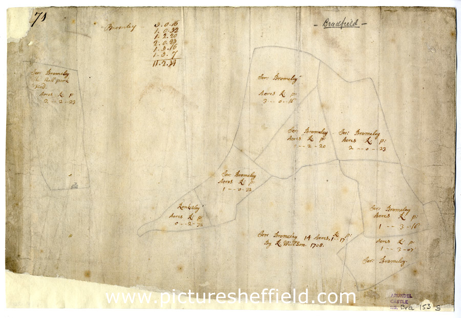
| Several fields at (probably) Stannington | |
| Sheffield_Stannington | |
| 1708 | |
| 1500-1799 | |
Scale not given [16 inches : 1 mile] Surveyor: [Robert Wilson]. Exact position unidentified but possibly near those in ACM/MAPS/Bra/156; a number of fields belonging to or tenanted by Jer. Bromeley and - Ronksley; acreages and Hall Park field named on the map. Dimensions: 37.5 x 25.5 cm. Original at Sheffield City Archives: ACM/MAPS/Bra/153s. Digitised with financial support from Sheffield and District Family History Society in memory of Professor David Hey (1938-2016) founder and life president of the Society.
|
Copying and access
This digital image, and all images on Picture Sheffield, are protected by copyright. You may use it for private study or non-commercial research, with due acknowledgement.
You may share it on social media via a linked post or by citing www.picturesheffield.com together with the Image Reference, unless its copyright is noted as belonging to another organisation. You must not reproduce it by any other means without permission.