Search Results
Found 122908 records
| No | Image | Details | Add to Album |
|---|---|---|---|
| 1 | 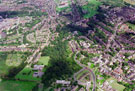 | w00967 Aerial view of Pitsmoor and Shirecliffe area. Firshill Crescent, centre. Barnsley Road and Scott Road, right. Roe Wood area, centre | |
| 2 | 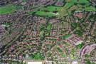 | w00968 Aerial view of Southey Green Estate. Moonshine Lane in foreground. Raisen Hall Road (including Longley School, right), Southey Crescent and Everingham Crescent, centre. | |
| 3 |  | w00969 Aerial view of Southey Green area. Southey Crescent and Raisen Hall Road (including Longley School), left in foreground. Herries Road and Herries Drive, centre. Northern General Hospital in background, right | |
| 4 | 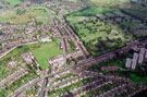 | w00970 Aerial view of Skye Edge and Manor Park area. City Road including Manor School in foreground. Manor Lane leading to Manor House, centre. City Road Cemetery in background, right. Roads in foreground include St. Aidan's Road | |
| 5 | 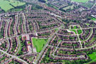 | w00971 Aerial view of Woodthorpe area. Woodthorpe Primary School, Woodthorpe Road, bottom, left. Woodland Avenue and Chadwick Road, centre. Prominent roads on right include Holbrook Road, Kilvington Avenue and Harthill Road | |
| 6 | 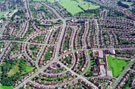 | w00972 Aerial view of Woodthorpe area. Woodthorpe Primary School, Woodthorpe Road, right. Hastilar Road South and Chadwick Road, centre. Other prominent roads include Fishponds Road and Aughton Crescent | |
| 7 |  | w00973 Aerial view of Handsworth area. Handsworth Road, centre. St. Joseph's Road (with Recreation Ground) and Hall Road, left | |
| 8 |  | w00974 Aerial view of Firth Park and Grimesthorpe area. Earl Marshal Campus and Owler Brook Nursery First School, Earl Marshal Road, centre. Whiteways Middle School, Whiteways Road, foreground, left. Prominent roads on right include Owler Lane and Rushby St | |
| 9 | 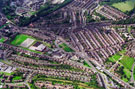 | w00975 Aerial view Grimesthorpe and Firth Park area. Prominent roads in foreground include Whiteways Road and Earl Marshal Road (including Earl Marshal Campus and Owler Brook Nursery First School). Owler Lane, Rushby Street and Hinde street, right | |
| 10 | 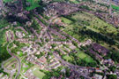 | w00976 Aerial view of Shirecliffe/Pitsmoor area. Prominent roads include Firshill Crescent, left. Barnsley Road leading to Burngreave Road and Pitsmoor Road, centre. Scott Road and Burngreave Cemetery in background |
Found 122908 records.