Search Results
Found 124626 records
| No | Image | Details | Add to Album |
|---|---|---|---|
| 1 |  | s12326 Footbridge over Wyming Brook | |
| 2 |  | s12327 Wyming Brook | |
| 3 |  | s12328 Wyming Brook | |
| 4 |  | s12331 Among the pines, Wyming Brook | |
| 5 |  | s12332 Wyming Brook Drive | |
| 6 |  | s12333 Wyming Brook | |
| 7 | 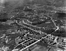 | s12357 Aerial view - Longley Estate showing Sheffield Corporation Moonshine Reservoir, Moonshine Lane (middle right of picture), Shirecliffe Secondary School, Penrith Road/Longley Avenue (extreme left of picture) and Herries Road (through centre of picture) | |
| 8 |  | s12358 Aerial view - Mowbray Street, Harvest Lane and Neepsend Lane (centre of picture) showing St. Michael and All Angels Church, Neepsend Lane, Steel Works, Mowbray Street, L.N.E.Railway, River Don, Kelham Island | |
| 9 |  | s12364 Aerial view - Longley Estate showing Sheffield Corporation Moonshine Reservoir, Moonshine Lane, Herries Road, Southey Green Council School(left) Longley Park (right), Longley North Council School and area to become Parson Cross estate (top of picture | |
| 10 | 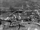 | s12367 Aerial view - Crowland Road, Hereward Road (bottom of picture), Elm Lane and Deerlands Avenue (across centre) |
Found 124626 records.