Search Results
Found 124626 records
| No | Image | Details | Add to Album |
|---|---|---|---|
| 1 | ![]() | arc03398 A map of certain lands held of the Earl of Surrey by William Holdsworth [land either side of the site of modern Shoreham Street, and of Clough House] | |
| 2 | ![]() | arc03399 Plan of Clough House, with stable, garden and kitchen garden, [c. 1778-1801] | |
| 3 | ![]() | arc03400 A map of several closes near The Farm | |
| 4 | ![]() | arc03405 A plan of the field between the tail goit of the Lead Mill and the Corn Mill dam, with additions to be made to the tail goit, [18th cent] | |
| 5 | ![]() | arc03406 A map of Cinderhill Wheel Old Dam and the additions intended to be made to it | |
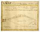
| 6 | ![]() | arc03414 A plan of the Stand Ley Closes, etc | |
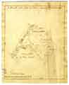
| 7 | ![]() | arc03415 A map of the Stand Leys and some other contiguous Lands with the Dam and Mill (formerly called Cinder Hill Wheel) | |
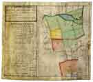
| 8 | ![]() | arc03416 A Survey of ye Clough w[hi]ch is taken out of Ezra Hobson and Francis Wortley's Farm | |
| 9 | ![]() | arc03417 A map of the lands held by George Crook under the Duke of Norfolk and of those let to William Blonk in 1767 | |
| 10 | ![]() | arc03422 A plan of the tenements, etc., on the Castle Hill in Sheffield demised by the Duke of Norfolk to John Waite |
Found 124626 records.
![A map of certain lands held of the Earl of Surrey by William Holdsworth [land either side of the site of modern Shoreham Street, and of Clough House] A map of certain lands held of the Earl of Surrey by William Holdsworth [land either side of the site of modern Shoreham Street, and of Clough House]](https://www.picturesheffield.com/imagefiles/jpgs_sheffield3//arc03398.jpg)
![Plan of Clough House, with stable, garden and kitchen garden, [c. 1778-1801] Plan of Clough House, with stable, garden and kitchen garden, [c. 1778-1801]](https://www.picturesheffield.com/imagefiles/jpgs_sheffield3//arc03399.jpg)

![A plan of the field between the tail goit of the Lead Mill and the Corn Mill dam, with additions to be made to the tail goit, [18th cent] A plan of the field between the tail goit of the Lead Mill and the Corn Mill dam, with additions to be made to the tail goit, [18th cent]](https://www.picturesheffield.com/imagefiles/jpgs_sheffield3//arc03405.jpg)


![A Survey of ye Clough w[hi]ch is taken out of Ezra Hobson and Francis Wortley's Farm A Survey of ye Clough w[hi]ch is taken out of Ezra Hobson and Francis Wortley's Farm](https://www.picturesheffield.com/imagefiles/jpgs_sheffield3//arc03416.jpg)

