Search Results
Found 124626 records
| No | Image | Details | Add to Album |
|---|---|---|---|
| 1 | ![]() | arc04092 West Field estate late Ann Carr’s but now R Bayley’s, measured for dividing into building lots; with the line of Devonshire Street drawn across it, and a lot of William Flockton’s coloured, [1823] | |
| 2 | ![]() | arc02436 Map of Attercliffe (Map No. XII) | |
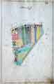
| 3 | ![]() | arc02437 Map of Attercliffe (Map No. XIII) | |
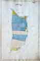
| 4 | ![]() | arc02438 Map of Attercliffe (Map No. XIV) | |
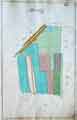
| 5 | ![]() | arc02439 Map of Attercliffe (Map No. XV) | |
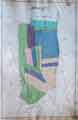
| 6 | ![]() | arc02440 Map of Attercliffe (Map No. XVI) | |
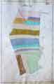
| 7 | ![]() | arc04093 Section of a proposed road from Division Street across Broomhall Lane into the Sheffield and Glossop road, to be called Devonshire Street, [1823] | |
| 8 | ![]() | arc04094 Plan of the corner of Balm Green and Blind Lane, measures taken in Balm Green to fix the line of Division Street where it will pass through the Towns' property; sketch showing the street after the demolition of the old Town property, [1792], 18 | |
| 9 | ![]() | arc04096 Plan of vacant land, the property of Verdon Brittain, Robert Robinson Brownell and Charles Brownell | |
| 10 | ![]() | arc04097 Plan of certain building land the property of Messrs Brittain, Wilkinson and Brownell |
Found 124626 records.
![West Field estate late Ann Carr’s but now R Bayley’s, measured for dividing into building lots; with the line of Devonshire Street drawn across it, and a lot of William Flockton’s coloured, [1823] West Field estate late Ann Carr’s but now R Bayley’s, measured for dividing into building lots; with the line of Devonshire Street drawn across it, and a lot of William Flockton’s coloured, [1823]](https://www.picturesheffield.com/imagefiles/jpgs_sheffield3//arc04092.jpg)


![Section of a proposed road from Division Street across Broomhall Lane into the Sheffield and Glossop road, to be called Devonshire Street, [1823] Section of a proposed road from Division Street across Broomhall Lane into the Sheffield and Glossop road, to be called Devonshire Street, [1823]](https://www.picturesheffield.com/imagefiles/jpgs_sheffield3//arc04093.jpg)
![Plan of the corner of Balm Green and Blind Lane, measures taken in Balm Green to fix the line of Division Street where it will pass through the Towns' property; sketch showing the street after the demolition of the old Town property, [1792], 18 Plan of the corner of Balm Green and Blind Lane, measures taken in Balm Green to fix the line of Division Street where it will pass through the Towns' property; sketch showing the street after the demolition of the old Town property, [1792], 18](https://www.picturesheffield.com/imagefiles/jpgs_sheffield3//arc04094.jpg)

