Search Results
Found 120609 records
| No | Image | Details | Add to Album |
|---|---|---|---|
| 1 | ![Sheffield Patent Brick Co. Ltd., [Brickworks, Broadfield Park Road] - plan of boiler house, engine house, brick machine, etc., c. 1870s Sheffield Patent Brick Co. Ltd., [Brickworks, Broadfield Park Road] - plan of boiler house, engine house, brick machine, etc., c. 1870s](https://www.picturesheffield.com/imagefiles/jpgs_sheffield3//arc07338.jpg) | arc07338 Sheffield Patent Brick Co. Ltd., [Brickworks, Broadfield Park Road] - plan of boiler house, engine house, brick machine, etc., c. 1870s | |
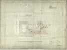
| 2 |  | arc07337 Sheffield Patent Brick Co. Ltd., Brickworks, Broadfield Park Road - site plan, c. 1870s | |
| 3 | ![Sheffield Patent Brick Co. Ltd., [Brickworks, Broadfield Park Road] - rear elevation, c. 1870s Sheffield Patent Brick Co. Ltd., [Brickworks, Broadfield Park Road] - rear elevation, c. 1870s](https://www.picturesheffield.com/imagefiles/jpgs_sheffield3//arc07339.jpg) | arc07339 Sheffield Patent Brick Co. Ltd., [Brickworks, Broadfield Park Road] - rear elevation, c. 1870s | |
| 4 |  | arc07340 P. Ashberry and Sons Ltd., manufacturer of spoons and Britannia metal goods, etc, Bowling Green Street - site plan, 1870s | |
| 5 |  | arc07341 P. Ashberry and Sons Ltd., manufacturer of spoons and Britannia metal goods, etc, Bowling Green Street - floor plans, 1870s | |
| 6 |  | arc07342 P. Ashberry and Sons Ltd., manufacturer of spoons and Britannia metal goods, etc, Bowling Green Street - elevations, 1870s | |
| 7 |  | arc07345 P. Ashberry and Sons Ltd., manufacturer of spoons and Britannia metal goods, etc, Bowling Green Street - section on line A-B | |
| 8 |  | arc07343 P. Ashberry and Sons Ltd., manufacturer of spoons and Britannia metal goods, etc, Bowling Green Street - elevation next Bowling Green Street, 1870s | |
| 9 |  | arc07344 P. Ashberry and Sons Ltd., manufacturer of spoons and Britannia metal goods, etc, Bowling Green Street - roof plan, 1870s | |
| 10 | ![P. Ashberry and Sons Ltd., manufacturer of spoons and Britannia metal goods, etc, Bowling Green Street - section on line C-D, [1874] P. Ashberry and Sons Ltd., manufacturer of spoons and Britannia metal goods, etc, Bowling Green Street - section on line C-D, [1874]](https://www.picturesheffield.com/imagefiles/jpgs_sheffield3//arc07346.jpg) | arc07346 P. Ashberry and Sons Ltd., manufacturer of spoons and Britannia metal goods, etc, Bowling Green Street - section on line C-D, [1874] |
Found 120609 records.