Search Results
Found 120609 records
| No | Image | Details | Add to Album |
|---|---|---|---|
| 1 |  | q00061 Ordnance Survey Map, sheet no. Yorkshire No. 294.7.16 | |
| 2 |  | q00062 Ordnance Survey Map, sheet no. Yorkshire No. 294.7.19 | |
| 3 |  | arc06797 Horse drawn dray used for deliveries of produce of Nichols and Co., wholesale grocers and tea, coffee and fruit merchants | |
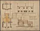
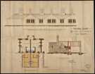
| 4 |  | arc08462 Shrewsbury Hospital, Norfolk Road, plan of proposed alterations | |
| 5 |  | arc08463 Shrewsbury Hospital, Norfolk Road, plan of proposed alterations | |
| 6 |  | arc06821 Proposed street improvements, Sheffield | |
| 7 |  | arc06823 Sheffield, Chesterfield and Staffordshire Railway | |
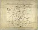
| 8 |  | arc06824 Map Explanatory of the Southern frontier Defences of the Brigantes and Northumbrians | |
| 9 |  | arc06830 Plan of Derbyshire by John Dower | |
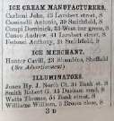
| 10 |  | y15051 Extract from White's trade directory showing Italian ice cream manufacturers in Sheffield |
Found 120609 records.