Search Results
Found 1301 records
| No | Image | Details | Add to Album |
|---|---|---|---|
| 1 | 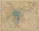 | y18035 Charles Hooper and Co. Ltd's Map of Sheffield | |
| 2 |  | y18049 Ordnance Survey of Yorkshire 1890-96: Attercliffe and part of Darnall | |
| 3 | 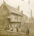 | t17653 Old Queen's Head public house (formerly the Hall in the Ponds), No. 40 Pond Hill | |
| 4 |  | y18010 Borough of Sheffield, Moorhead Improvement Scheme as proposed by Councillor George Skinner | |
| 5 |  | arc04575 Map of Sheffield Park the Property of His Grace the Duke of Norfolk, [early 19th cent] | |
| 6 |  | arc04582 Tracing made from the plans attached to the Sheffield Award dated 25 Sep 1805, [after 1828] | |
| 7 |  | arc04581 Tracing made from the plans attached to the Sheffield Award dated 25 Sep 1805, [after 1828] | |
| 8 |  | arc04577 Plan of the Duke of Norfolk's estate in the Township of Brightside Bierlow in the Parish of Sheffield | |
| 9 | 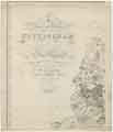 | arc04585 A map of the County of Nottingham (north-west) | |
| 10 | 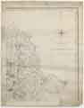 | arc04586 A map of the County of Nottingham (north-east) |
Found 1301 records.