Search Results
Found 2491 records
| No | Image | Details | Add to Album |
|---|---|---|---|
| 1 |  | y18015 Sketch plan used to illustrate The Replanning of Sheffield by R D Bennett. Map No 4 Milton Street area | |
| 2 |  | y18016 Sketch plan used to illustrate The Replanning of Sheffield by R D Bennett. Map No 5 Milton Street area | |
| 3 |  | y18017 Sketch plan used to illustrate The Replanning of Sheffield by R D Bennett. Map No 6 Arundel Street area - 'suggested works-flats' | |
| 4 |  | y18019 Geographia plan of Sheffield, [1937] | |
| 5 |  | y18021 Plan of Sheffield | |
| 6 | 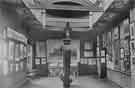 | w03468 Ruskin Museum, Meersbrook Park, opened 1890 | |
| 7 | 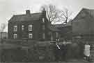 | w03476 Ivy House Farm, The Dale, Woodseats | |
| 8 | 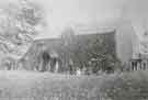 | w03499 Crabtree Ivies, Crabtree Drive | |
| 9 | 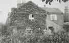 | w03501 Crabtree Ivies, Crabtree Drive | |
| 10 |  | w03504 Crabtree Lane looking towards Wincobank Hill |
Found 2491 records.