Search Results
Found 6460 records
| No | Image | Details | Add to Album |
|---|---|---|---|
| 1 |  | arc04598 A map of the Hall Carr Farm as it is now subdivided, Royds Mill Farm and sundry other contiguous Lands of the Earl of Surrey in the Township of Brightside Bierlow | |
| 2 | ![A map of Shirecliff [sic] Hall Farm: with the intermediate and adjoining Woods, belonging to the Duke of Norfolk](https://www.picturesheffield.com/imagefiles/jpgs_sheffield3//arc04599.jpg "A map of Shirecliff [sic] Hall Farm: with the intermediate and adjoining Woods, belonging to the Duke of Norfolk") | arc04599 A map of Shirecliff [sic] Hall Farm: with the intermediate and adjoining Woods, belonging to the Duke of Norfolk | |
| 3 | ![Windy House Farm, near the Manor [Sheffield Park], [1768]](https://www.picturesheffield.com/imagefiles/jpgs_sheffield3//arc04601.jpg "Windy House Farm, near the Manor [Sheffield Park], [1768]") | arc04601 Windy House Farm, near the Manor [Sheffield Park], [1768] | |
| 4 |  | arc04602 The Windy House Farm in Sheffield Park | |
| 5 | ![A map of the lands held by George Townsend and Mark Furniss jointly, under the Duke of Norfolk, [1768]](https://www.picturesheffield.com/imagefiles/jpgs_sheffield3//arc04603.jpg "A map of the lands held by George Townsend and Mark Furniss jointly, under the Duke of Norfolk, [1768]") | arc04603 A map of the lands held by George Townsend and Mark Furniss jointly, under the Duke of Norfolk, [1768] | |
| 6 |  | y18001 Ecclesall Inclosure: Crookesmoor, Little Sheffield Moor and Sheffield Moor | |
| 7 |  | y18000 Ecclesall Inclosure | |
| 8 | 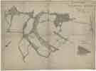 | y18002 Ecclesall Inclosure | |
| 9 | 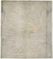 | arc04604 A map of Certain Lands in Sheffield Park belonging to the Duke of Norfolk occupied principally by Geo. Townsend and James Furniss ... | |
| 10 | 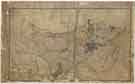 | y18006 A Map of the Parish of Sheffield in the County of York |
Found 6460 records.