Search Results
Found 7279 records
| No | Image | Details | Add to Album |
|---|---|---|---|
| 1 | 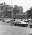 | u14457 Barker's Pool looking towards Holly Street showing (left) Cambridge House (former Waterworks offices, Division Street) | |
| 2 | 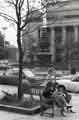 | u14458 Barker's Pool looking towards (top left) Holly Street showing (back) City Hall and (centre) Barker's Pool war memorial | |
| 3 | 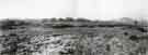 | u14459 Tinsley Park looking North showing the view from the footpath at Darnall to Tinsley [marshalling] yard, Wood Lane | |
| 4 | 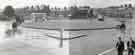 | u14461 Roundabout at the junctions of (left) Queens Road, (top right) St. Mary's Road, (centre right) Suffolk Road and (bottom) Granville Road | |
| 5 |  | u14463 House building in unidentified area | |
| 6 |  | u14464 Moorhead looking towards Backfields and Cambridge Street, No. 2 Jays Furnishing Stores, house furnishers and James Coombes and Co. Ltd., boot and shoe repairers | |
| 7 | 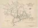 | y18037 Major Pedestrian Routes across the Civic Circle [City Centre] | |
| 8 | 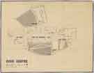 | y18038 Civic Centre: Plan at main pedestrian level | |
| 9 |  | y18039 Civic Centre: Plan at service road, car parking and storage level | |
| 10 |  | y18040 Civic Centre: elevations |
Found 7279 records.