Search Results
Found 7025 records
| No | Image | Details | Add to Album |
|---|---|---|---|
| 1 |  | arc04588 A map of the County of Nottingham (south-west) | |
| 2 |  | arc04591 A plan of Gallowtree Hill Field, White Cross Field and Hammer Acre in which the several Allotments, and the original Properties of which they consist, and their several quantities, are marked (Rotherham / Treeton) | |
| 3 | 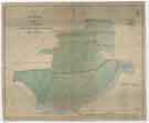 | arc04593 A map of the Estate in the Township of Kimberworth belonging to Samuel Kirk | |
| 4 | ![East view of Sheffield in 1745 [from Park Hill], from the original sketch by Samuel Buck](https://www.picturesheffield.com/imagefiles/jpgs_sheffield3//u13900.jpg "East view of Sheffield in 1745 [from Park Hill], from the original sketch by Samuel Buck") | u13900 East view of Sheffield in 1745 [from Park Hill], from the original sketch by Samuel Buck | |
| 5 | 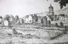 | w02952 Backfields | |
| 6 | 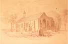 | w03114 Attercliffe Chapel of Ease and burial ground, Hill Top, Attercliffe Common | |
| 7 | 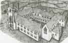 | w03390 Beauchief Abbey, off Abbey Lane | |
| 8 |  | arc04573 A plan of Handsworth Commons | |
| 9 | ![A survey of The Hayfield Spring in the Parish of Handsworth [High Field Spring Wood, Handsworth]](https://www.picturesheffield.com/imagefiles/jpgs_sheffield3//arc04572.jpg "A survey of The Hayfield Spring in the Parish of Handsworth [High Field Spring Wood, Handsworth]") | arc04572 A survey of The Hayfield Spring in the Parish of Handsworth [High Field Spring Wood, Handsworth] | |
| 10 |  | arc08589 A map of two parcels of freehold land and buildings at Attercliffe |
Found 7025 records.