Search Results
Found 15819 records
| No | Image | Details | Add to Album |
|---|---|---|---|
| 1 | 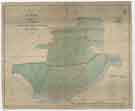 | arc04593 A map of the Estate in the Township of Kimberworth belonging to Samuel Kirk | |
| 2 | ![Map of Attercliffe, [c. 1815 - 1849]](https://www.picturesheffield.com/imagefiles/jpgs_sheffield3//arc04597.jpg "Map of Attercliffe, [c. 1815 - 1849]") | arc04597 Map of Attercliffe, [c. 1815 - 1849] | |
| 3 | 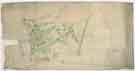 | arc04600 Plan of building lots on Park Hill, extending from the Canal Basin to Shrewsbury Street, and east to Park Hill Lane, c. 1800 | |
| 4 | 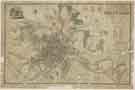 | y18007 A Map of the Town and Environs of Sheffield in the West Riding of the County of York | |
| 5 | 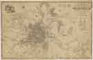 | y18008 A Map of the Town and Environs of Sheffield in the West Riding of the County of York | |
| 6 | 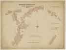 | y18009 Borough of Sheffield Street Improvements | |
| 7 |  | arc04414 Robert Wilson's map of Loxley, early 18th cent | |
| 8 | ![Plans endorsed Holdworth and Loxley allotments, no. 2 [at Holdworth, on Kirk Edge Road, and beside Long Lane], [1785]](https://www.picturesheffield.com/imagefiles/jpgs_sheffield3//arc04415.jpg "Plans endorsed Holdworth and Loxley allotments, no. 2 [at Holdworth, on Kirk Edge Road, and beside Long Lane], [1785]") | arc04415 Plans endorsed Holdworth and Loxley allotments, no. 2 [at Holdworth, on Kirk Edge Road, and beside Long Lane], [1785] | |
| 9 | ![The East End, and Chancel part of the Old Church at Sheffield, which belongs to his Grace the Duke of Norfolk [St Marie's Roman Catholic Church?]](https://www.picturesheffield.com/imagefiles/jpgs_sheffield3//arc04433.jpg "The East End, and Chancel part of the Old Church at Sheffield, which belongs to his Grace the Duke of Norfolk [St Marie's Roman Catholic Church?]") | arc04433 The East End, and Chancel part of the Old Church at Sheffield, which belongs to his Grace the Duke of Norfolk [St Marie's Roman Catholic Church?] | |
| 10 | 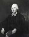 | u12642 Rev. James Wilkinson (1763 - ), JP |
Found 15819 records.