Search Results
Found 16037 records
| No | Image | Details | Add to Album |
|---|---|---|---|
| 1 | ![Map of Attercliffe, [c. 1815 - 1849]](https://www.picturesheffield.com/imagefiles/jpgs_sheffield3//arc04597.jpg "Map of Attercliffe, [c. 1815 - 1849]") | arc04597 Map of Attercliffe, [c. 1815 - 1849] | |
| 2 | 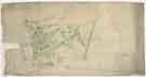 | arc04600 Plan of building lots on Park Hill, extending from the Canal Basin to Shrewsbury Street, and east to Park Hill Lane, c. 1800 | |
| 3 | 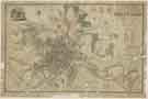 | y18007 A Map of the Town and Environs of Sheffield in the West Riding of the County of York | |
| 4 | 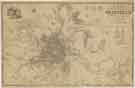 | y18008 A Map of the Town and Environs of Sheffield in the West Riding of the County of York | |
| 5 | 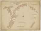 | y18009 Borough of Sheffield Street Improvements | |
| 6 | ![Rotherham: Moorgate, [1767] [1783]](https://www.picturesheffield.com/imagefiles/jpgs_sheffield3//arc04403.jpg "Rotherham: Moorgate, [1767] [1783]") | arc04403 Rotherham: Moorgate, [1767] [1783] | |
| 7 |  | arc04404 A survey of all the cottages and farm houses situate amongst them in Whiston, which are held by sundry persons of the Duke of Norfolk, 1791 | |
| 8 | ![Outline plan, with numbers, of the Duke of Norfolk's estate, at Whiston, [1794]](https://www.picturesheffield.com/imagefiles/jpgs_sheffield3//arc04405.jpg "Outline plan, with numbers, of the Duke of Norfolk's estate, at Whiston, [1794]") | arc04405 Outline plan, with numbers, of the Duke of Norfolk's estate, at Whiston, [1794] | |
| 9 | ![Part of the Duke of Norfolk's lands near Wickersley Common, Whiston, [1794]](https://www.picturesheffield.com/imagefiles/jpgs_sheffield3//arc04406.jpg "Part of the Duke of Norfolk's lands near Wickersley Common, Whiston, [1794]") | arc04406 Part of the Duke of Norfolk's lands near Wickersley Common, Whiston, [1794] | |
| 10 | ![Part of the Duke of Norfolk's lands at Whiston, [1794]](https://www.picturesheffield.com/imagefiles/jpgs_sheffield3//arc04407.jpg "Part of the Duke of Norfolk's lands at Whiston, [1794]") | arc04407 Part of the Duke of Norfolk's lands at Whiston, [1794] |
Found 16037 records.