Search Results
Found 8039 records
| No | Image | Details | Add to Album |
|---|---|---|---|
| 1 | ![The Earl of Surrey's tenements between Bower Street and New Hall Street, [1781] The Earl of Surrey's tenements between Bower Street and New Hall Street, [1781]](https://www.picturesheffield.com/imagefiles/jpgs_sheffield3//arc04286.jpg) | arc04286 The Earl of Surrey's tenements between Bower Street and New Hall Street, [1781] | |
| 2 | ![Town land, extending from Broad Lane End to West Bar, [1778] Town land, extending from Broad Lane End to West Bar, [1778]](https://www.picturesheffield.com/imagefiles/jpgs_sheffield3//arc04287.jpg) | arc04287 Town land, extending from Broad Lane End to West Bar, [1778] | |
| 3 | ![Building lots between West Bar Green and Silver Street, [1794] Building lots between West Bar Green and Silver Street, [1794]](https://www.picturesheffield.com/imagefiles/jpgs_sheffield3//arc04288.jpg) | arc04288 Building lots between West Bar Green and Silver Street, [1794] | |
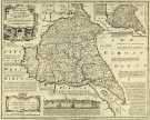
| 4 |  | y14987 County Map of Yorkshire East Riding, by Emanuel Bowen, Thomas Kitchin and others, c. 1777 | |
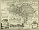
| 5 |  | y14988 County Map of Yorkshire North Riding, by Emanuel Bowen, Thomas Kitchin and others, c. 1777 | |
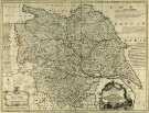
| 6 |  | y14989 County Map of Yorkshire, by Emanuel Bowen, Thomas Kitchin and others, c. 1777 | |
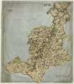
| 7 |  | y14990 County Map of Derbyshire, by Emanuel Bowen, Thomas Kitchin and others, c. 1777 | |
| 8 | ![Map of the East Riding of Yorkshire by Robert Morden, [c.1720s] Map of the East Riding of Yorkshire by Robert Morden, [c.1720s]](https://www.picturesheffield.com/imagefiles/jpgs_sheffield3//arc06826.jpg) | arc06826 Map of the East Riding of Yorkshire by Robert Morden, [c.1720s] | |
| 9 |  | arc06825 West Riding of Yorkshire | |
| 10 | ![Map of the North Riding of Yorkshire by Robert Morden, [c. 1690s] Map of the North Riding of Yorkshire by Robert Morden, [c. 1690s]](https://www.picturesheffield.com/imagefiles/jpgs_sheffield3//arc06827.jpg) | arc06827 Map of the North Riding of Yorkshire by Robert Morden, [c. 1690s] |
Found 8039 records.