Search Results
Found 16045 records
| No | Image | Details | Add to Album |
|---|---|---|---|
| 1 |  | h01378 New Royal Hallamshire Hospital, Glossop Road | |
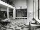
| 2 |  | h01379 Empty reception room prior to opening, Royal Hallamshire Hospital, Glossop Road | |
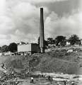
| 3 |  | h01380 Construction work on new teaching hospital, (Royal Hallamshire Hospital), Glossop Road showing (top right) St. Mark C. of E. Church, Broomfield Road | |
| 4 |  | h01381 Construction work on site of new teaching hospital, (Royal Hallamshire Hospital), Glossop Road showing (top left) St. Mark C. of E. Church, Broomfield Road | |
| 5 |  | h01382 Construction work on site of new teaching hospital, (Royal Hallamshire Hospital), Glossop Road showing (top left) St. Mark C. of E. Church, Broomfield Road | |
| 6 |  | h01383 Construction work on site of new teaching hospital, (Royal Hallamshire Hospital), Glossop Road showing (top left) St. Mark C. of E. Church, Broomfield Road | |
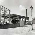
| 7 |  | h01384 Construction work on site of new teaching hospital, (Royal Hallamshire Hospital), Glossop Road | |
| 8 |  | h01385 Construction work on site of new teaching hospital, (Royal Hallamshire Hospital), Glossop Road showing (top left) Arts Tower, University of Sheffield and (top centre and right) Netherthorpe flats | |
| 9 |  | h01386 Construction work on site of new teaching hospital, (Royal Hallamshire Hospital), Glossop Road showing (top left) Arts Tower, University of Sheffield and (top centre and right) Netherthorpe flats | |
| 10 |  | h01387 Construction work on site of new teaching hospital, (Royal Hallamshire Hospital), Glossop Road showing (top left) Arts Tower, University of Sheffield and (top centre and right) Netherthorpe flats |
Found 16045 records.