Search Results
Found 12516 records
| No | Image | Details | Add to Album |
|---|---|---|---|
| 1 | 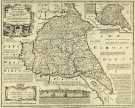 | y14987 County Map of Yorkshire East Riding, by Emanuel Bowen, Thomas Kitchin and others, c. 1777 | |
| 2 | 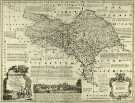 | y14988 County Map of Yorkshire North Riding, by Emanuel Bowen, Thomas Kitchin and others, c. 1777 | |
| 3 | 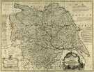 | y14989 County Map of Yorkshire, by Emanuel Bowen, Thomas Kitchin and others, c. 1777 | |
| 4 |  | y14990 County Map of Derbyshire, by Emanuel Bowen, Thomas Kitchin and others, c. 1777 | |
| 5 | ![Map of the East Riding of Yorkshire by Robert Morden, [c.1720s] Map of the East Riding of Yorkshire by Robert Morden, [c.1720s]](https://www.picturesheffield.com/imagefiles/jpgs_sheffield3//arc06826.jpg) | arc06826 Map of the East Riding of Yorkshire by Robert Morden, [c.1720s] | |
| 6 | 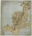 | arc06825 West Riding of Yorkshire | |
| 7 | ![Map of the North Riding of Yorkshire by Robert Morden, [c. 1690s] Map of the North Riding of Yorkshire by Robert Morden, [c. 1690s]](https://www.picturesheffield.com/imagefiles/jpgs_sheffield3//arc06827.jpg) | arc06827 Map of the North Riding of Yorkshire by Robert Morden, [c. 1690s] | |
| 8 | ![Plan of the West Riding of Yorkshire by Robert Morden, [c. 1690s] Plan of the West Riding of Yorkshire by Robert Morden, [c. 1690s]](https://www.picturesheffield.com/imagefiles/jpgs_sheffield3//arc06828.jpg) | arc06828 Plan of the West Riding of Yorkshire by Robert Morden, [c. 1690s] | |
| 9 | ![Map of Darbyshire [Derbyshire] by Robert Morden Map of Darbyshire [Derbyshire] by Robert Morden](https://www.picturesheffield.com/imagefiles/jpgs_sheffield3//arc06829.jpg) | arc06829 Map of Darbyshire [Derbyshire] by Robert Morden | |
| 10 | 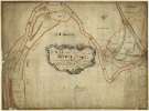 | arc07349 A map of the land belonging to Wortley Forges |
Found 12516 records.