Search Results
Found 5497 records
| No | Image | Details | Add to Album |
|---|---|---|---|
| 1 |  | u01276 The old Wheatsheaf Inn and Baines Garage, Ecclesall Road South, Parkhead. Demolished 1928 to make way for the present pub | |
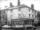
| 2 |  | u01278 Prince of Wales Public House, No 95, Ecclesall Road South at junction of Carter Knowle Road. Later known as Baltimore Diner, Woodstock Diner, Woodstock and Macaw. | |
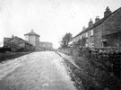
| 3 |  | u01285 Sheephill Road, looking towards the Round House and Norfolk Arms P. H., Ringinglow Road | |
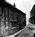
| 4 |  | u01515 Washford Bridge Old House which belonged to Elizabeth Roades in the 17th century, situated near Washford Bridge, Attercliffe Road, later known as Fleur-de-lis Inn, now demolished | |
| 5 |  | u01693 Rivelin near Woodend View, Hollins Bridge Corn Mill, (known earlier as Rivelin Bridge Mill, prior to conversion to corn mill) and Dam, Holly Bush Inn, Holly Lane, behind Mill, Hollins Farm (side view) in background | |
| 6 |  | u02075 Rose Cottage Public House, Cricket Inn Road | |
| 7 |  | u02077 Industry Inn, No 34, Broad Street and No 1, South Street | |
| 8 |  | u02078 Target Inn, No. 75, St. John's Road, Park | |
| 9 |  | u02419 Commercial Hotel, landlord John Jones, No 34, Button Lane and junction of Carver Street with Ginni Jones and unknown barman outside. Building on right has 'Moorhead Fish Restaurant' sign | |
| 10 |  | u02692 Nos 13 and 15a, Sheldon Street (on right) after demolition of properties. Side view of Sportman's Inn, No. 10, Denby Street, from Unstone Street, left, with ornate roof. Court No. 3, Sheldon Street was situated at rear of pub, behind wall |
Found 5497 records.