Search Results
Found 57 records
| No | Image | Details | Add to Album |
|---|---|---|---|
| 1 | ![Plan of the County of Darby [Derby], by John Seller, c. 1668 Plan of the County of Darby [Derby], by John Seller, c. 1668](https://www.picturesheffield.com/imagefiles/jpgs_sheffield2//arc02520.jpg) | arc02520 Plan of the County of Darby [Derby], by John Seller, c. 1668 | |
| 2 |  | y13572 Map of the County of Yorkshire, surveyed 1767-1770 by Thomas Jefferys | |
| 3 |  | y13573 Map of the County of Yorkshire, surveyed 1767-1770 by Thomas Jefferys | |
| 4 | 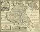 | y14987 County Map of Yorkshire East Riding, by Emanuel Bowen, Thomas Kitchin and others, c. 1777 | |
| 5 | 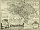 | y14988 County Map of Yorkshire North Riding, by Emanuel Bowen, Thomas Kitchin and others, c. 1777 | |
| 6 | 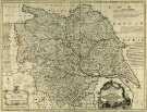 | y14989 County Map of Yorkshire, by Emanuel Bowen, Thomas Kitchin and others, c. 1777 | |
| 7 |  | y14990 County Map of Derbyshire, by Emanuel Bowen, Thomas Kitchin and others, c. 1777 |
Found 57 records.