Search Results
Found 523 records
| No | Image | Details | Add to Album |
|---|---|---|---|
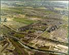
| 1 |  | w01026 Aerial view of Foxhill and Parson Cross area. Fox Hill Primary School, Keats Road, right. Chaucer School in background. Halifax Road and Cowper Crescent, centre. Chaucer Road and Wilcox Road, centre, left to right. Deerlands Avenue, bottom, left. | |
| 2 |  | w01054 Aerial view of Hollisend Road, Gleadless. Jaunty Park, Jaunty Lane, Hollinsend Avenue and Hollindale Drive, foreground. Gleadless School, Hollinsend Road, centre. Mansfield Road and Alnwick Road in background | |
| 3 |  | w01067 Aerial view of the grounds of Thornbridge Hall off the Monsal Trail (in background) | |
| 4 |  | w01068 Aerial view of Thornbridge Hall gate house off the Monsal Trail | |
| 5 |  | w01074 Aerial view of Wincobank area. Shiregreen Primary and Secondary School, Bracken Road, right. Shiregreen Lane and Shiregreen Cemetery in foreground. | |
| 6 |  | w01080 Aerial view of Lydgate Lane School showing Lydgate Lane, Tapton Hill Road and Tapton Bank (bottom) and Marsh Lane | |
| 7 |  | s29539 Aerial view showing Weedon Street (extreme left) from the bottom River Don; Meadowahall Road; Jenkin Road and Brightside Nursery First School; Tyler Street running parallel to Meadowhall Road and housing on Wincobank Hill | |
| 8 |  | s29688 Pitsmoor | |
| 9 |  | y06472 Cover of 'Sheffield into the 80's: a strategy for industry and jobs' | |
| 10 |  | u09173 Aerial view of Bents Green and Ringinglow Road, showing Bents Green Methodist Church on the corner of Ringinglow Road and Knowle Lane. |
Found 523 records.