Search Results


Found 519 records.

Page of 52.

Search Within Results

Keywords
Exclude
No Image Details Add to Album
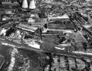
1Aerial view of East Hecla Works, Hadfields Ltd. and (top left) Blackburn Meadows Power Station and Tinsley Towerst12733

Aerial view of East Hecla Works, Hadfields Ltd. and (top left) Blackburn Meadows Power Station and Tinsley Towers

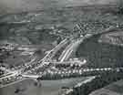
2Aerial View - Abbeydale Road South and Twentywell Lane and Railway Tracks, St. John's Church and Dore and Totley Station can be seen in backgrounds12421

Aerial View - Abbeydale Road South and Twentywell Lane and Railway Tracks, St. John's Church and Dore and Totley Station can be seen in background

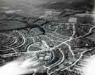
3Aerial View of Arbourthorne area. Arbourthorne Central School, Eastern Avenue, centre. Berners Road, left. East Bank Place, right. Fell Brigg Road and Eastern Drive in foregrounds08011

Aerial View of Arbourthorne area. Arbourthorne Central School, Eastern Avenue, centre. Berners Road, left. East Bank Place, right. Fell Brigg Road and Eastern Drive in foreground

4Aerial View of Arbourthorne. East Bank Road, centre.  Hurlfield Road, Hurlfield Drive and Gleadless Common, foreground. Dagnam Road, Atherton Road, Bazley Road and Dagnam Crescent in backgrounds08012

Aerial View of Arbourthorne. East Bank Road, centre. Hurlfield Road, Hurlfield Drive and Gleadless Common, foreground. Dagnam Road, Atherton Road, Bazley Road and Dagnam Crescent in background

5Controversial postcard depicting views of Sheffields10931

Controversial postcard depicting views of Sheffield

6Aerial View - Longley Estate showing Sheffield Corporation Moonshine Reservoir, Moonshine Lane (middle right of picture), Shirecliffe Secondary School, Penrith Road/Longley Avenue (extreme left of picture) and Herries Road (through centre of picture)s12357

Aerial View - Longley Estate showing Sheffield Corporation Moonshine Reservoir, Moonshine Lane (middle right of picture), Shirecliffe Secondary School, Penrith Road/Longley Avenue (extreme left of picture) and Herries Road (through centre of picture)

7Aerial View - Crowland Road, Hereward Road (bottom of picture), Elm Lane and Deerlands Avenue (across centre)s12367

Aerial View - Crowland Road, Hereward Road (bottom of picture), Elm Lane and Deerlands Avenue (across centre)

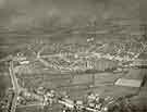
8Aerial View -  Shiregreen Estate under construction showing roads including Shirehall Road, Shirehall Crescent (bottom of picture), Wood Road and Sycamore House Road (top of picture) with Woolley Wood (top of picture)s12372

Aerial View - Shiregreen Estate under construction showing roads including Shirehall Road, Shirehall Crescent (bottom of picture), Wood Road and Sycamore House Road (top of picture) with Woolley Wood (top of picture)

9Aerial View - Atlas and Norfolk Works, Carlisle Street, Forncett Street, Carwood Road, Lyons Street, River Don and Muntion Huts on Munition Street(bottom of picture)s12381

Aerial View - Atlas and Norfolk Works, Carlisle Street, Forncett Street, Carwood Road, Lyons Street, River Don and Muntion Huts on Munition Street(bottom of picture)

10Aerial View - Broomhill towards Sharrow including (left-right) King Edward VII School, Newbould Lane leading to Clarkegrove Rd, Sheffield Girls High School and Rutland Park, foreground, Clarkehouse Road, centre, Sharrow and General Cemetery in distans12385

Aerial View - Broomhill towards Sharrow including (left-right) King Edward VII School, Newbould Lane leading to Clarkegrove Rd, Sheffield Girls High School and Rutland Park, foreground, Clarkehouse Road, centre, Sharrow and General Cemetery in distan

Found 519 records.

Page of 52.