Search Results
Found 523 records
| No | Image | Details | Add to Album |
|---|---|---|---|
| 1 | 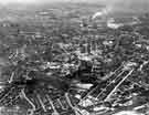 | s44084 Highfield, Sharrow and St. Marys showing (centre) St. Mary's C. of E. Church; Bramall Lane football ground and the City Centre c.1957 | |
| 2 | 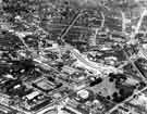 | s44086 View of (right) Highfield and (top) the City Centre showing (centre) St. Marys Gate and Ellin Street, (right) St. Marys C. of E. Church, Bramall Lane and (bottom) Bramall Lane football ground c.1957 | |
| 3 |  | s44098 Handsworth showing (right) Handsworth Road, (centre) St. Mary C.of E. Church and (left) Handsworth Parish Centre | |
| 4 |  | s44099 Handsworth showing (centre) Handsworth Road and St. Mary C.of E. Church and (bottom) Handsworth Parish Centre | |
| 5 | 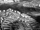 | s44100 Gleadless Valley Housing Estate showing (centre) Blackstock Road; (left) Gaunt Road; (right) Raeburn Road; and Morland Road | |
| 6 | 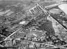 | s44110 Park and Norfolk Park showing (centre) Cholera Monument and Memorial Gardens, off Norfolk Road (foreground) Shrewsbury Road and (right) Granville Road and Norfolk Park | |
| 7 | 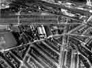 | s44111 Highfield and St. Marys showing (centre) Bramall Lane football ground, (right) Alderson Road (top) Queens Road (top left running right) Shoreham Street and Edmund Road c.1950 | |
| 8 | 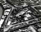 | s46107 Aerial view looking SE with Princess Street in the foreground. Windsor Street is to the left and in the foreground under the railway bridge | |
| 9 | 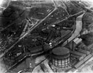 | s02475 Aerial view of Thomas W. Ward's, Albion Works, Savile Street. | |
| 10 | 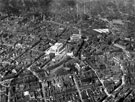 | s12334 Aerial view - City Centre, including Town Hall and St. Paul's Church, Pinstone Street, City Hall (under construction), Barker's Pool, Central Telephone Exchange, West Street and Leopold Street, note construction of Central Library, Surrey Street |
Found 523 records.