Search Results
Found 523 records
| No | Image | Details | Add to Album |
|---|---|---|---|
| 1 |  | s22731 Aerial view of Kelvin Flats area. Roads in foreground include Albert Terrace, Upperthorpe Road and Daniel Hill (including Upperthorpe Baths). Infirmary Road in background | |
| 2 |  | s26137 Aerial view of Bramall Lane football ground, Bramall Lane bottom; John Street (left) and Shoreham Street (top) with Charlotte Road running diagonally | |
| 3 |  | s26138 Aerial view Bramall Lane football ground | |
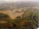
| 4 |  | s26967 Aerial view of Sheffield Airport under construction with the M1 Motorway right and Shefffield Parkway bottom | |
| 5 |  | s26968 Aerial view of Sheffield Airport under construction with Sheffield Parkway bottom | |
| 6 |  | s26969 Aerial view of Sheffield Airport | |
| 7 |  | w00807 Aerial view of St. Catherine's RC First and Middle School, Shirecliffe. Firshill Crescent in background. Roe Lane, right | |
| 8 |  | w00820 Greenhill Primary School, Greenhill Main Road, foreground, right. Meadow Head Avenue, Allenby Drive and Reney Road, foreground. Parkway Road in background | |
| 9 |  | w00825 Aerial view of Nether Edge area. Prominent roads include Abbeydale Road, centre (including Abbeydale Primary School). Sandford Grove Road and Rupert Road in foreground | |
| 10 |  | w00826 Aerial view of Nether Edge area. Includes Abbeydale Road (including Abbeydale Primary School), foreground. Machon Bank and Sheldon Road, right, centre. Little London Road, foreground, left |
Found 523 records.