Record Detail
Large format version available - click on Zoom button to browse this image in a zoomable viewer
| arc04047 | |
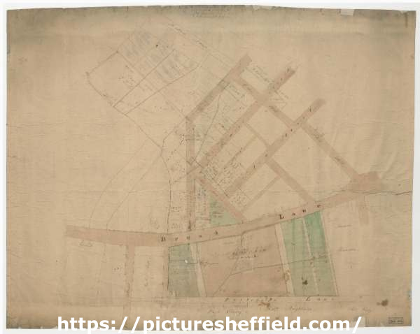
| Broad Lane. Streets laid out in the Burgesses’ land, c. 1790 - 1806 | |
| Sheffield_Netherthorpe | |
| 1500-1799 | |
The base of the plan was made before FC/P/SheS/141S, and does not show so many building lots. It also includes the streets between Broad Lane and Portobello, with St. George Square set out. Shows Broad Lane, Solly Street, Edward Street, Corn Hill, Red Hill, Radeford Street [sic], Siddall Street, Beet Street, Gell Street, Portobello Lane. Dimensions approx. 80 x 64 cm. Original at Sheffield City Archives: FC/P/Shes/140L. Digitised with financial support from Sheffield and District Family History Society in memory of Professor David Hey (1938-2016) founder and life president of the Society.
|
Copying and access
This digital image, and all images on Picture Sheffield, are protected by copyright. You may use it for private study or non-commercial research, with due acknowledgement.
You may share it on social media via a linked post or by citing www.picturesheffield.com together with the Image Reference, unless its copyright is noted as belonging to another organisation. You must not reproduce it by any other means without permission.