Place the cursor on an image to see its title. Click to enlarge and obtain more information.
Click on add to album to keep a working record of the images you are interested in |
Place the cursor on an image to see its title. Click to enlarge and obtain more information.
Click on add to album to keep a working record of the images you are interested in |
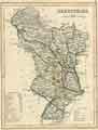
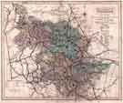
![View: arc01951 A new map of the county of Derby [Derbyshire] divided into hundreds, by Thomas Dix](https://www.picturesheffield.com/imagefiles/jpgs_sheffield2//arc01951.jpg)
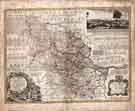
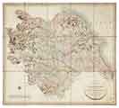
![View: arc02520 Plan of the County of Darby [Derby], by John Seller, c. 1668](https://www.picturesheffield.com/imagefiles/jpgs_sheffield2//arc02520.jpg)
;)
;)
;)
;)
;)
;)
;)
;)
;)
;)