Record Detail
Large format version available - click on Zoom button to browse this image in a zoomable viewer
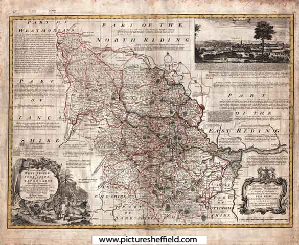
| y09345 | |
| An Accurate Map of the West Riding of Yorkshire, divided into its Wapontakes | |
| Yorkshire | |
| 1785 | |
| 1500-1799 | |
Drawn from Surveys, with various additional Improvements: Illustrated with Historical Extracts relative to its Natural Produce, Mines, Minerals, Manufactures, Trade and the present state of its Principal Towns. By Emanuel Bowen. Scale 20 miles : 4.8 inches. Size 71 x 53 cm. Original at Sheffield Local Studies Library: E 1 L. |
Copying and access
This digital image, and all images on Picture Sheffield, are protected by copyright. You may use it for private study or non-commercial research, with due acknowledgement.
You may share it on social media via a linked post or by citing www.picturesheffield.com together with the Image Reference, unless its copyright is noted as belonging to another organisation. You must not reproduce it by any other means without permission.