Record Detail
Large format version available - click on Zoom button to browse this image in a zoomable viewer
| arc02096 | |
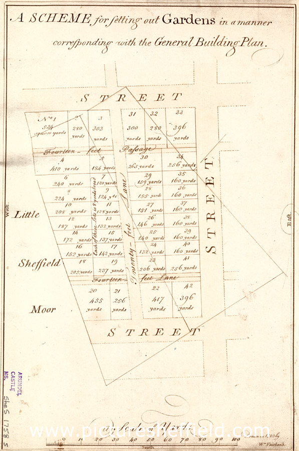
| A scheme for setting out gardens in a manner corresponding with the General Building Plan | |
| Sheffield_City_Centre | |
| 1783 | |
| 1500-1799 | |
Surveyor: William Fairbank II. Scale 20 yards : 1 inch. Dimensions: 33 x 21 cm. Subdivision of two of the fields shown on ACM/MAPS/SheS/1774L between Furnival Street, Duke Street (modern Matilda Street) and Eyre Street. Measurements of each garden given on the map. Original at Sheffield City Archives ref. ACM/MAPS/Shes/1758S. |
Copying and access
This digital image, and all images on Picture Sheffield, are protected by copyright. You may use it for private study or non-commercial research, with due acknowledgement.
You may share it on social media via a linked post or by citing www.picturesheffield.com together with the Image Reference, unless its copyright is noted as belonging to another organisation. You must not reproduce it by any other means without permission.