Record Detail
Large format version available - click on Zoom button to browse this image in a zoomable viewer
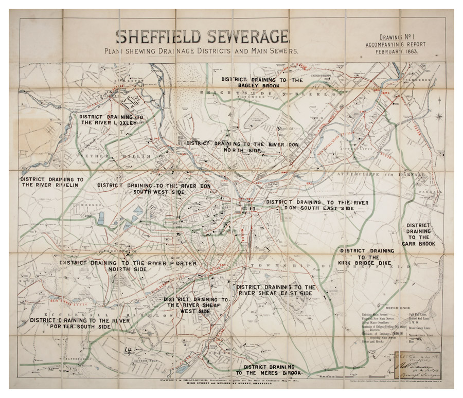
| arc00048 | |
| Plan showing drainage districts and main sewers | |
| Sheffield | |
| 1883 | |
| 1851-1899 | |
On a base map published by Pawson and Brailsford. Signed by Charles Gott, Bradford [West Yorkshire] and Robert Davidson, Borough Engineer. Scale: 1 inch to 700 feet. Original at Sheffield Archives SY18/2. |
Copying and access
This digital image, and all images on Picture Sheffield, are protected by copyright. You may use it for private study or non-commercial research, with due acknowledgement.
You may share it on social media via a linked post or by citing www.picturesheffield.com together with the Image Reference, unless its copyright is noted as belonging to another organisation. You must not reproduce it by any other means without permission.
BUY A PRINT
copy(ies)