Search Results
Found 523 records
| No | Image | Details | Add to Album |
|---|---|---|---|
| 1 |  | u10591 Aerial view of shops on Middlewood Road, Hillsborough showing (l.to r.) Kentucky Fried Chicken; William Talbot Ltd., butchers and Crusty's, bakers | |
| 2 | 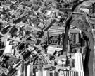 | s22111 Aerial view of Neepsend showing Infirmary Road, Penistone Road, River Don, Ball Street Bridge and Kelham Weir, Cornish Place Works, Cornish Works, Green Lane, Neepsend Lane (bottom), Neepsend Bridge and Neepsend Gas Works | |
| 3 | 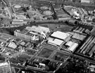 | s22112 Aerial view of Neepsend showing Penistone Road, Samuel Osborn and Co., Mushet Tool Works, River Don, Neepsend Lane, | |
| 4 | 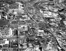 | s22113 Aerial view of Neepsend and Kelvin showing Kelvin Flats (top left), Royal Infirmary, Infirmary Road, site of St. Philips Church, Penistone Road, River Don and Neepsend Gas Works (right) | |
| 5 | 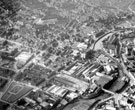 | s22114 Aerial view of Neepsend showing Royal Infirmary, Infirmary Road, site of St Philips Church, Penistone Road, River Don, Neepsend Lane Regent Works, Rutland Works and Bacon Island | |
| 6 |  | u10601 Aerial view of (right) Leppings Lane at junction with (bottom) Catch Bar Lane, Hillsborough showing (centre) Wortleys Guytee Ltd.,mill furnishers | |
| 7 | 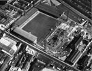 | s26136 Aerial view of the redevelopment of Bramall Lane football and cricket ground, Cherry Street (right); Bramall Lane bottom; John Street (left) and Shoreham Street (top) | |
| 8 | 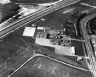 | s26958 Aerial view of Park House School, Bawtry Road (right),Tinsley and M1 Motorway left | |
| 9 | 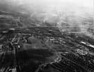 | s26959 Aerial view of M1 Motorway, Tinsley Viaduct from Wincobank Hill area Summer 1976 | |
| 10 |  | s26960 Aerial view of M1 Motorway, Tinsley Viaduct showing Tinsley Roundabout; Bawtry Road (right); River Don; Sheff and SYK Navigation; Blackburn Meadows Power Station and Hadfields Co. Ltd., East Hecla Works left |
Found 523 records.