Record Detail
Large format version available - click on Zoom button to browse this image in a zoomable viewer
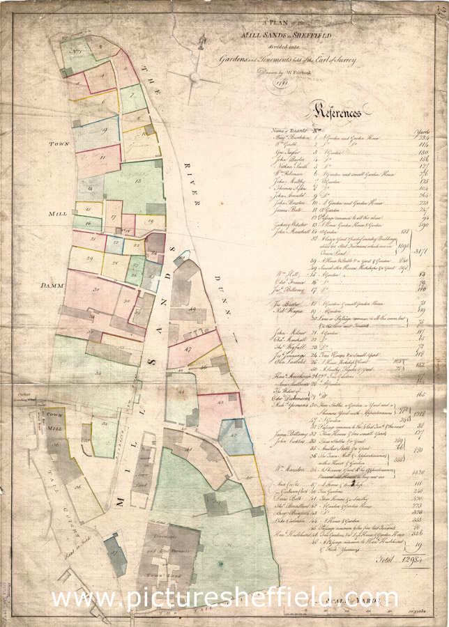
| arc02092 | |
| A plan of the Mill Sands in Sheffield divided into gardens and tenements held of the Earl of Surrey | |
| Sheffield_City_Centre | |
| 1781 | |
| 1500-1799 | |
Surveyor: William Fairbank II. Scale 10 yards : 1 inch. Dimensions: 74 x 52 cm. A large plan of the whole area between the Town Mill dam and the River Don including the Town Mill and the steel furnace; most of the tenements (coloured) are gardens but there are some houses, smithies, skinner's yards, etc; also cutlers grinding wheel, the Tail Goight, steel furnaces; numerical list with tenants names, descriptions and measurements. Original at Sheffield City Archives ref. ACM/MAPS/Shes/1495L. |
Copying and access
This digital image, and all images on Picture Sheffield, are protected by copyright. You may use it for private study or non-commercial research, with due acknowledgement.
You may share it on social media via a linked post or by citing www.picturesheffield.com together with the Image Reference, unless its copyright is noted as belonging to another organisation. You must not reproduce it by any other means without permission.