Record Detail
Large format version available - click on Zoom button to browse this image in a zoomable viewer
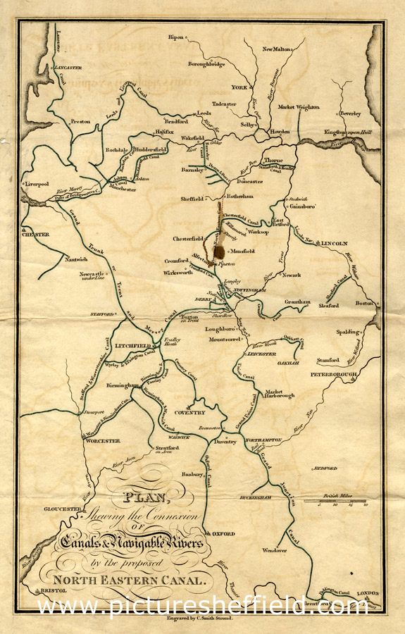
| arc02904 | |
| Plan showing the connexion of canals and navigable rivers by the proposed north-eastern canal, 19th cent | |
| Sheffield | |
| 1800-1850 | |
By C. Smith, Strand. From Bristol in the south to York in the north, Liverpool in the west and Hull in the east) Original at Sheffield City Archives: WWM/MP/8/14 (altrefno WWM/MP/77) |
Copying and access
This digital image, and all images on Picture Sheffield, are protected by copyright. You may use it for private study or non-commercial research, with due acknowledgement.
You may share it on social media via a linked post or by citing www.picturesheffield.com together with the Image Reference, unless its copyright is noted as belonging to another organisation. You must not reproduce it by any other means without permission.