Record Detail
Large format version available - click on Zoom button to browse this image in a zoomable viewer
| arc02936 | |
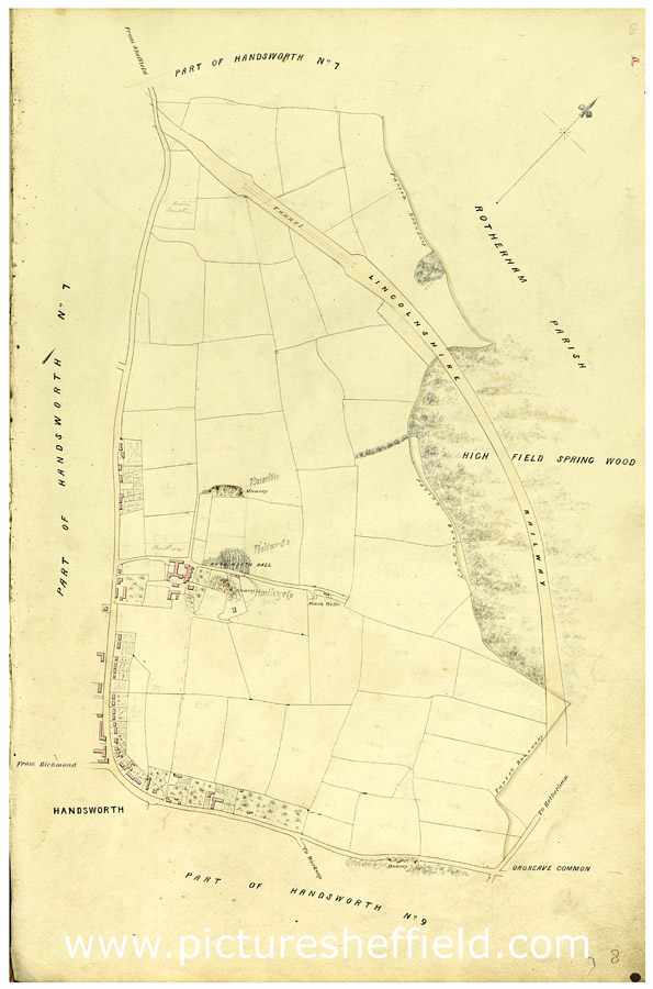
| Map of Handsworth, etc., c.1855 | |
| Sheffield_Handsworth | |
| 1851-1899 | |
Includes Handsworth House, Finch Wells, quarry, Lincolnshire Railway, Highfield Spring Wood and Orgreave Common. From a volume of maps of the parish of Handsworth, based on the enclosure award maps (1805) and corrected up to 1855. Dimensions of original: 34 x 51 cm. Original at Sheffield City Archives: CA369/1. |
Copying and access
This digital image, and all images on Picture Sheffield, are protected by copyright. You may use it for private study or non-commercial research, with due acknowledgement.
You may share it on social media via a linked post or by citing www.picturesheffield.com together with the Image Reference, unless its copyright is noted as belonging to another organisation. You must not reproduce it by any other means without permission.